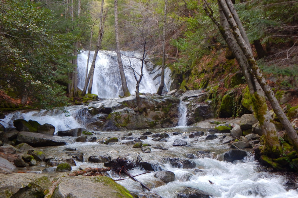
Lassen Volcanic National Park

Hiking and Biking Trails

The Shasta Cascade Region offers an abundance of prime backpacking and hiking areas. Just check any map of the Northstate and virtually anywhere you look is going to be public lands or close to public land. The eight National Forests and numerous wilderness areas in the Shasta Cascade Region all offer fantastic trails. Besides going out on your own, there are several reputable guide services in the Shasta Cascade Region. These can provide a once-in-a-lifetime family experience using either horses or llamas for carrying those camping essentials, or take the avid fisherman or hunter to a remote locale they would never find on their own.

For specific information about public lands, review the public lands pages on this site and contact those agencies which manage the area you are considering for your back country experience. Remember to pack your camera, a few snacks, and plenty of water, and as always, tread lightly!

+ Filter Results
12345Next
5479
CA 95973
(530) 533-1473
Situated in rural north state, the Sierra Oro Farm Trail (SOFT) is a non-profit association of farmers and businesses located in Butte County, California. Established in 2005 with a handful of local farms, the trail has grown to include more than thirty specialty farms and agriculture-related businesses from throughout the communities of Butte County.The farm trail community rolls out the red carpet every Columbus Day weekend for the annual Passport Weekend. During the Passport Weekend,…
Butte County
5541
Bidwell Park
Chico, CA 95928
(530) 899-1500
One of the largest municipal parks in the nation, Bidwell Park is an extraordinary landscape filled with swimming holes, trails and picnic areas. Families will find paved bike trails throughout the park and mountain bikers can test their skills on the many intertwined trails in the upper park.Bidwell Park is "divided" by Manzanita Avenue. The area east of Manzanita Avenue is referred to as Middle and Upper Park, while the area west of Manzanita is…
Butte County
5374
1 Indian Well HQ
Tulelake, CA 0
The Big Nasty Trail is a fantastic loop trail that is named after a brush-covered formation of rough lava rock. Sweeping views of Lava Beds and the Modoc National Forest can be seen from here, and the trail is a fantastic spot to view the sunset. From the Mammoth Crater/Hidden Valley pullout, the trail starts just before the upper overlook and follows the crater rim before heading west toward Ponderosa pine forests.
Siskiyou County
2806
Bizz Johnson National Recreation Trail
Susanville, CA 0
530-257-3252
Following the old Fernley and Lassen Branch Line of the Southern Pacific railroad, the trail winds 25.4 miles from Susanville, California to Mason Station. For the first 16 miles, the trail follows the Susan River. As it winds through the rugged Susan River Canyon, the trail crosses the river 12 times on bridges and trestles and passes through two tunnels.
Lassen County
5383
Redding, CA 0
This trail travels through a canyon near a seasonal creek, and the old Blue Gravel Mine, once a gold mine in the area operated by the City. Relics from this era are still visible from the trail. Much of the trail offers trees and shade. Distance: 1.75 Miles (Placer St. to Starburst Rd.)Difficulty: Slight Hill
Shasta County
5384
21820 Lassen National Park Hwy
Mineral, CA 96063
A number of steam vents are located under Boiling Springs Lake, keeping the temperature of the lake around 125 degrees. The mud pots on the southeast shore are among the best in the park. The trail crosses a meadow and then goes through forest to the lake and around it. Trees include incense-cedar, ponderosa pine, Douglas-fir, white fir, sugar pine, and others. A variety of wildflowers are found and it is a good area to…
Tehama County
2866
14412 Kennedy Memorial Drive
Whiskeytown, CA 96095
530-246-1225
At over 138 feet tall, Boulder Creek Falls was thought to be the tallest waterfall in Whiskeytown National Park until the re-discovery of Whiskeytown Falls in 2004. With three cascades down a canyon covered in moss and ferns, you'll feel like you're in a dream.Driving Time: 15 mins / 9.44 miles from ReddingDistance: 2.25 miles (one way)Difficulty: Moderate
Shasta County
5554
Boundary Trail - Kangaroo Segment National Recreation Trail
CA 0
(530) 493-1718
This trail provides spectacular views of the Red Butte and surrounding mountains. Southern exposure near the ridge top, good views, rough country, lots of rock and brush.
Siskiyou County
2167
14412 Kennedy Memorial Drive
Whiskeytown, CA 96095
530-246-1225
Brandy Creek Falls is one of the widest waterfalls in Whiskeytown National Park with five cascades that rush over the granite rock of the canyon. Here you will find the unique Indian Rhubarb displaying bright colors in spring and fall. This trail connects to Rich Gulch Trail. This waterfall is accessible by trail. A map of the trail to Brandy Creek Falls is available at the Whiskeytown Visitor Center. Driving Time: 15 mins/9.44 miles from…
Shasta County
5388
21820 Lassen National Park Hwy
Mineral, CA 96063
For sheer beauty and rugged mountain scenery the Brokeoff trail is one of the best in Lassen. The trail climbs steadily through open meadows and forest for two miles and then through scattered hemlocks and finally above timberline to the top. At the west end of the mountain just before the last half mile of the climb, there is a good view of Mt. Shasta. From the top of the mountain there are good views…
Tehama County
12345Next
Showing results 1 to 10 of 53
Shasta Cascade Wonderland Association
1699 HWY 273, Anderson, CA 96007 | (P) 530-365-7500
Things to Do | Wine & Dine | Events | Planning | Stay | Regions | Partners | Media | About Us | Contact Us
Website Developed by Drozian Webworks